R&O’s GIS and information technology professionals are highly trained and stay current on new technology. We are committed to maintaining the highest standard in this area and continue to make significant investments in mapping equipment, software and ongoing education for data managers.
Mapping and GIS Services
Comprehensive GIS Services
R&O’s information infrastructure integrates research and mapping data to provide a complete GIS solution. Our unique systems ensure the highest quality maps are available more quickly and our focus on availability ensures a cooperative and responsive environment for your project.
We have experience in all GIS areas:
- 3D Lidar Digital elevation modeling (DEM)
- XY Data Conversion
- Well Location and Analysis
- Metes, Bounds, and Quarter Call Descriptions
- CAD Conversion
- Data Analysis
- Model Building
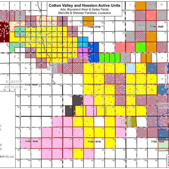
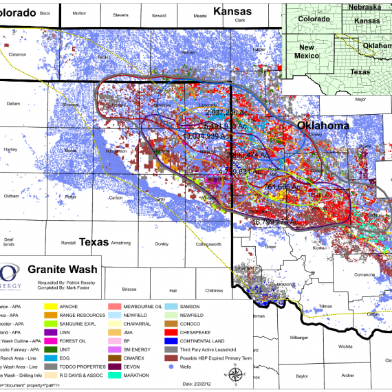
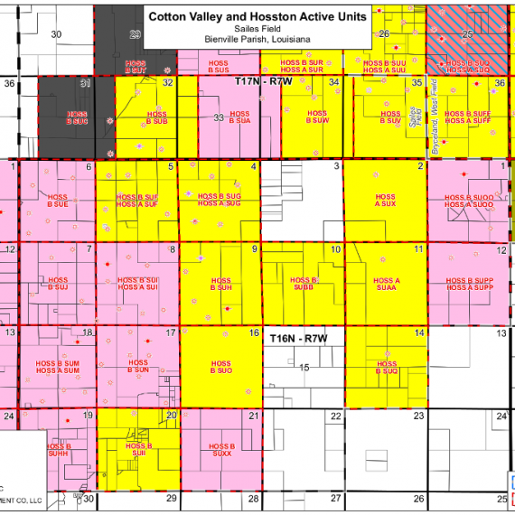
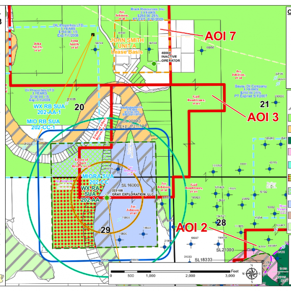
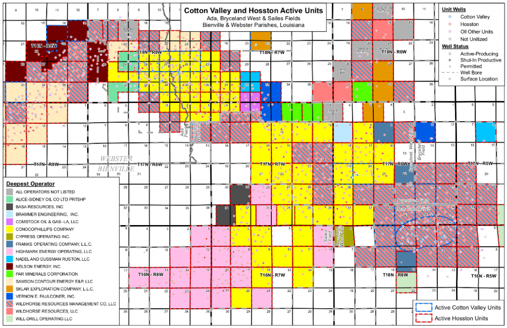
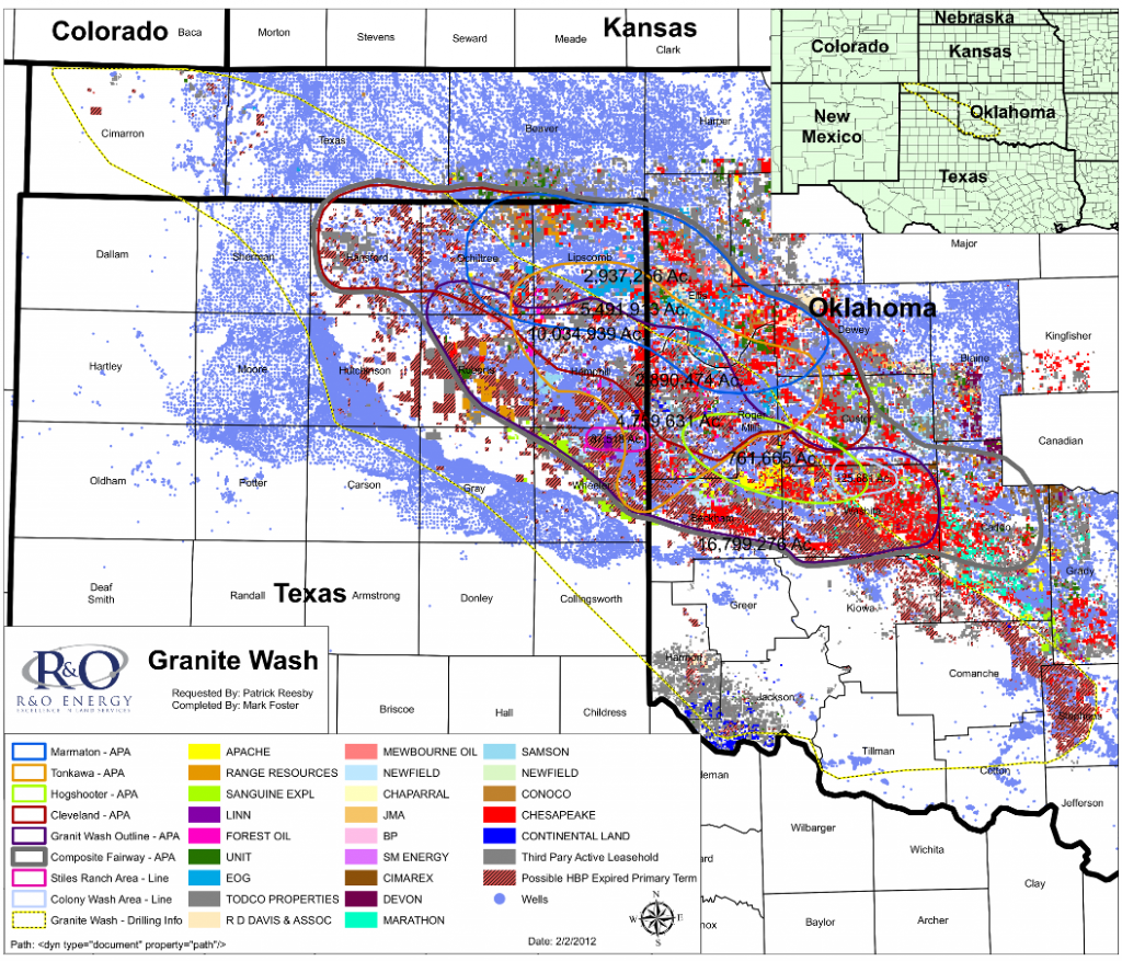
Our Work
Aerial Mapping
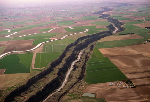
R&O’s clients rely on our imagery partners to provide high resolution, historical images to solve issues such as:
- Accretion
- Dereliction
- Avulsion
- Riparian zone